Garmin HuntView™ Plus Maps
Garmin HuntView™ Plus Maps
Regular price
$44.99 USD
Regular price
$89.99 USD
Sale price
$44.99 USD
Unit price
per
sku: 010-12512-05
Shipping calculated at checkout.
Couldn't load pickup availability
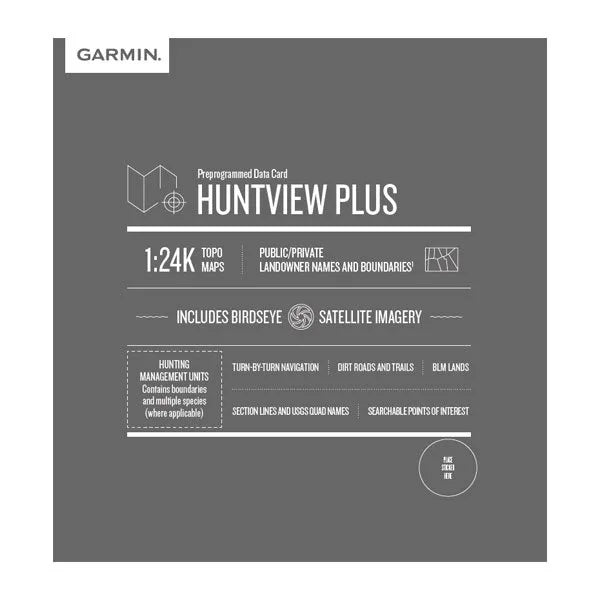
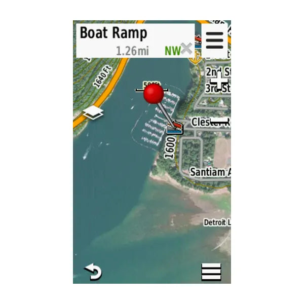
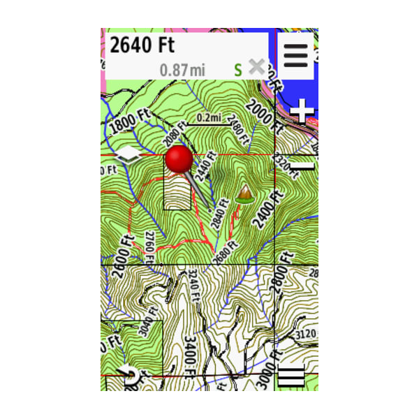
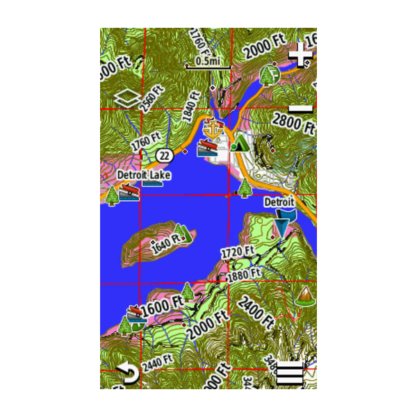

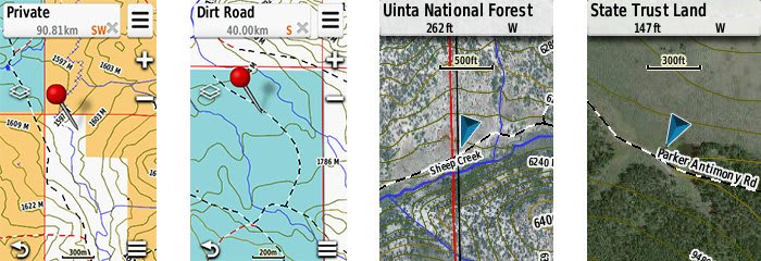
Featuring exclusive BirdsEye Satellite Imagery and 1:24K scale TOPO mapping, these preloaded microSD™ cards offer a seamless hunting map solution for Garmin handheld GPS devices. Map data is collected from multiple sources, providing full state-by-state coverage with routable road and trail data, landowner names and boundaries for public/private land types and boundaries (BLM, National wildlife refuges, National parks, WPA, WMA), food/fuel locations and more. Included BaseCamp™ software lets you interface your computer with your handheld device to plan your hunt, transfer waypoints, and even keep a track log so you can return to the best hunting spots or share the adventure online.
- Easy-to-use mapping solution for hunters and outdoorsmen – plug-in microSD card or download the mapping to a blank microSD card from home
- Identifies landowner names and boundaries for public/private land types and boundaries, using data from multiple sources for superior coverage and detail
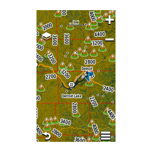
- Digital topography equivalent to 1:24,000 scale U.S. Geological Survey maps
- Shows thousands of routable roads and trails with turn-by-turn navigation
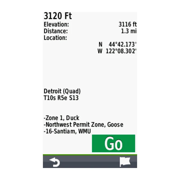
- Includes searchable points of interest: parks, summits, geographic place names, camping areas, businesses, and more
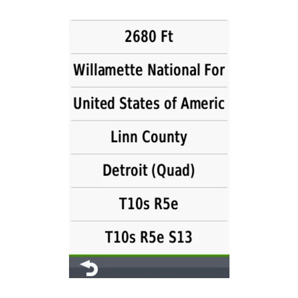
- Provides Bureau of Land Management township, range and section information, plus USGS quad location
- Includes hunting management units – containing boundaries and multiple species (where applicable). A device software update is required to view this information and some updates are coming soon. Learn more.
- Compatible with BaseCamp software for managing data on your GPS and computer, trip planning, playing back routes and tracks, geotagging photos and more
- Full state coverage for other states, sold individually.