


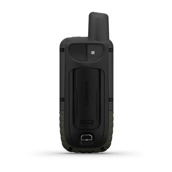
Garmin GPSMAP® 66s
Garmin GPSMAP® 66s
Couldn't load pickup availability

NAVIGATE YOUR NEXT ADVENTURE
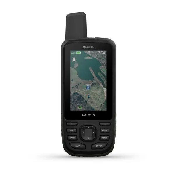
Whether you’re hiking, hunting, climbing, geocaching, kayaking or mountain biking, explore more by using this premium, rugged handheld with a 3” color display.
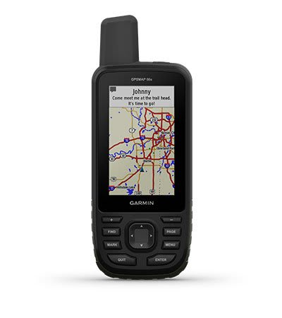
No matter the conditions, you’ll be able to see the large, sunlight-readable color display.
Just GPS is great, but multi-GNSS satellite support and outdoor sensors are better.
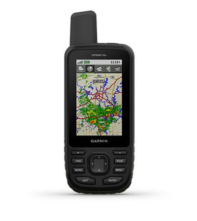
Maps as pretty as a picture and just as detailed.
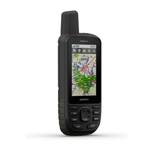
See what’s coming with Active Weather, and never again be surprised by those clouds rolling in.
Open up a world of off-grid capabilities with the Garmin Explore™ website and app.
Go the distance with up to 16 hours of battery life in GPS mode and 1 week in Expedition mode.

Know the way.
MULTI-GNSS SUPPORT
Access multiple global navigation satellite systems (GPS, GLONASS and Galileo) to track in more challenging environments than GPS alone.
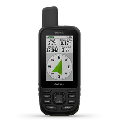
ABC SENSORS
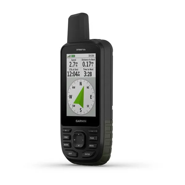
Navigate every trail with ABC sensors, including an altimeter for elevation data, barometer to monitor weather and 3-axis electronic compass.
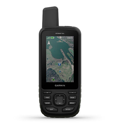
BIRDSEYE SATELLITE IMAGERY
Download high-resolution photo-realistic maps directly to your device without an annual subscription. Easily find trails, pick stand locations, find parking, create waypoints and more.
ACTIVE WEATHER
When paired with your compatible smartphone, you can get real-time forecast information and live weather radar, so you’re always aware of the surrounding conditions.
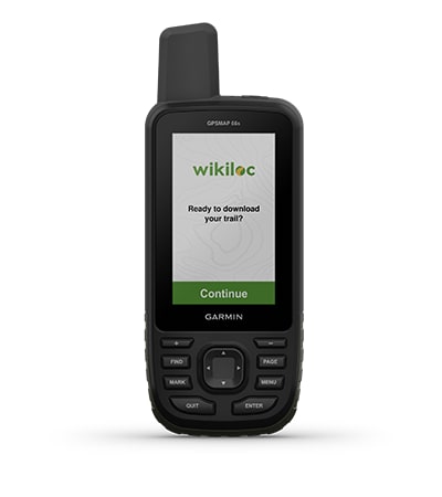
WIKILOC TRAILS
This preloaded app lets you easily download hiking, cycling and other Wikiloc trails shared by outdoor enthusiasts like you. Get a free 60-day Wikiloc Premium trial to try this and other exclusive features.
Physical & Performance
| Display Size | 1.5"W x 2.5"H (3.8 x 6.3 cm); 3" diag (7.6 cm) |
| Battery type | 2 AA batteries (not included); NiMH or Lithium recommended |
| Display resolution | 240 x 400 pixels |
| GPS | Yes |
| Dimension | 2.5" x 6.4" x 1.4" (6.2 x 16.3 x 3.5 cm) |
| Interface | high speed micro USB and NMEA 0183 compatible |
| Waterproof | IPX7 |
| Weight |
8.1 oz (230 g) with batteries |
| Display Type | transflective color TFT |
| Battery life |
Up to 16 hours |
| High-sensitivity receiver | Yes |
Maps & Navigation
| External memory storage | yes (32 GB max microSD™ card) |
| Waypoints/favorites/locations | 10000 |
| Basemap | Yes |
| Navigation Routes | 250, 250 points per route; 50 points auto routing |
| Navigation Track Log | 20000 points, 250 saved gps tracks, 300 saved fit activities |
| Memory/History | 16 GB |
| Ability to add maps | Yes |
- GPSMAP 66s
- Access to Birdseye Satellite Imagery
- USB cable
- Carabiner clip
- Documentation