


Garmin GPSMAP® 65, Multi-Band/Multi-GNSS Handheld
Garmin GPSMAP® 65, Multi-Band/Multi-GNSS Handheld
Couldn't load pickup availability

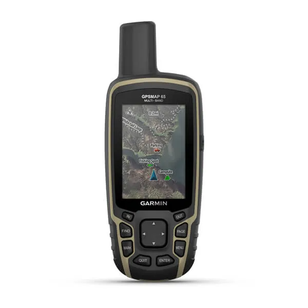
FIND YOUR WAY IN THIS BIG, WIDE WORLD
Explore more with this rugged handheld that offers multi-band frequency support for our most accurate position to date, a 2.6” color display and preloaded maps.
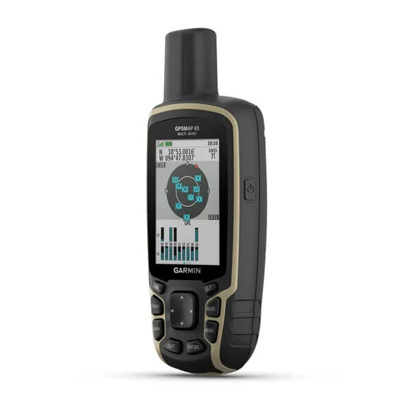
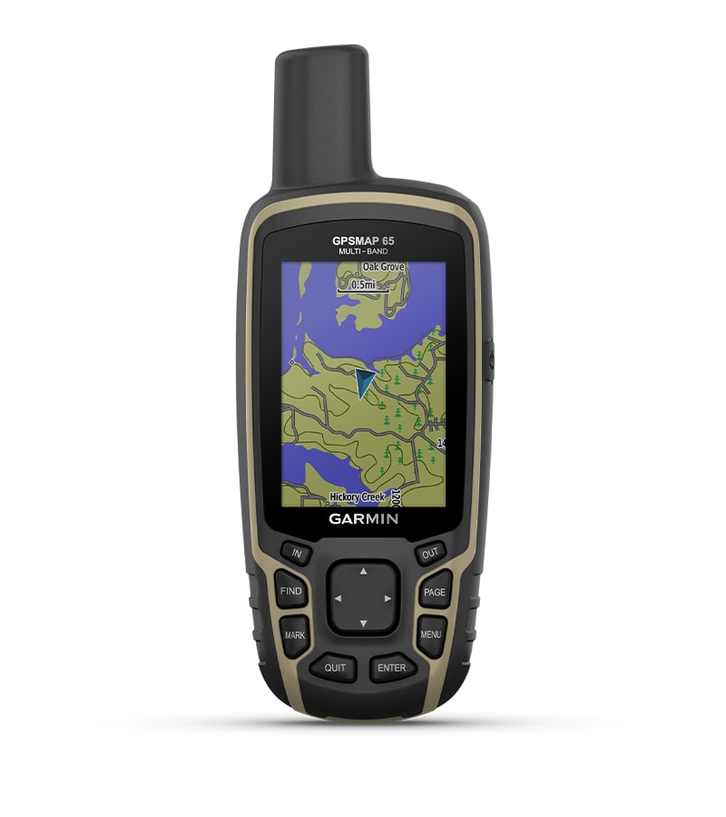
Don’t miss a detail with this large, sunlight-readable color display.
Lead the way in challenging locations with multi-band technology and expanded GNSS satellite support.
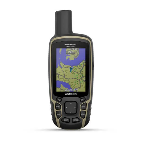
Cross the countryside with routable TopoActive maps for the U.S. and Canada.
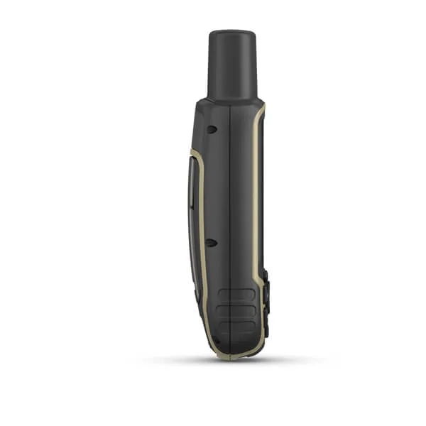
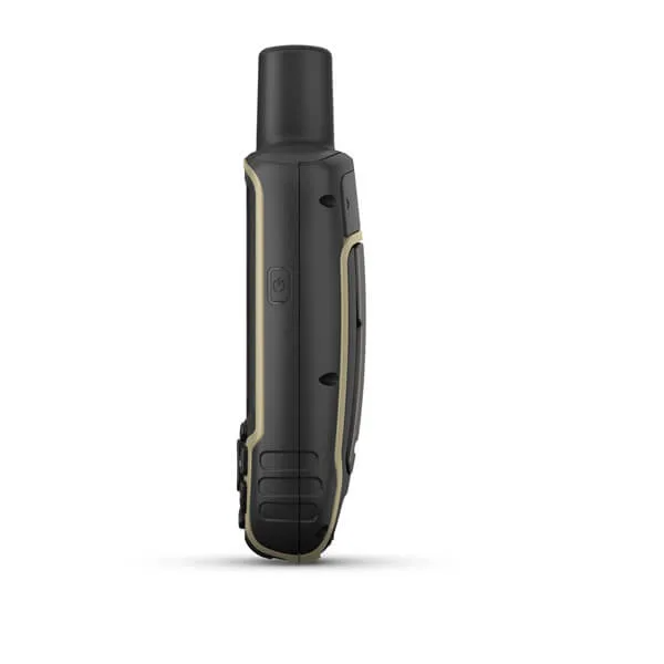
Venture confidently. This rugged handheld is built for tough environments.
Organize your adventure from anywhere with the Garmin Explore™ website and app1.
Travel with up to 16 hours of battery life in GPS mode.

Follow your path.
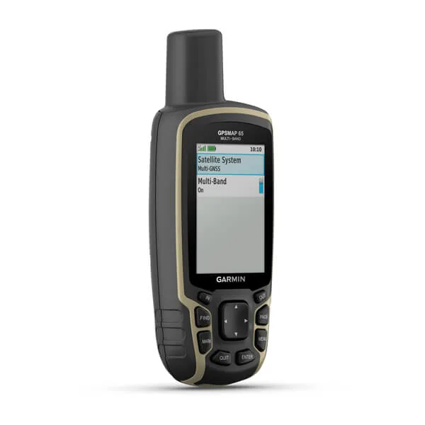
EXPANDED GNSS SUPPORT
Access multiple global navigation satellite systems (GPS, GLONASS, GALILEO and QZSS) to track in more challenging environments.
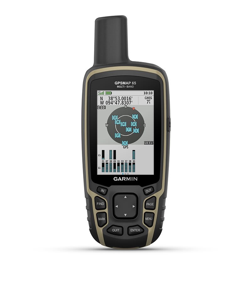
MULTI-BAND FREQUENCY SUPPORT
Receive and utilize multiple frequencies sent by navigation satellites which enables improved user position accuracy, specifically in areas where GNSS signals are reflected, weak or typically do not penetrate. Get superior accuracy using state of the art technology, previously only available to the military.
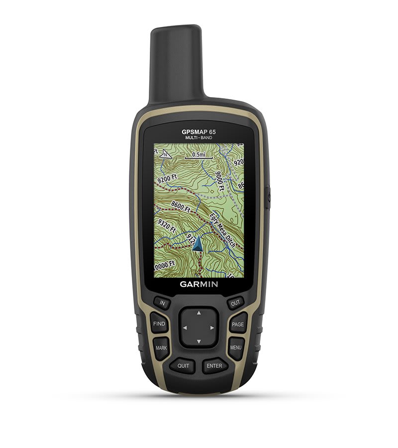
PRELOADED TOPO MAPS
Preloaded TopoActive U.S. and Canada maps show you terrain contours, topographic elevations, summits, parks, coastlines, rivers, lakes and geographical points.
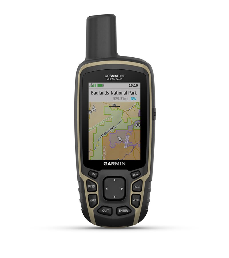
PUBLIC LAND BOUNDARIES
An optional display of federal public land boundaries on topographical maps helps you know that you’re venturing where you’re supposed to be.
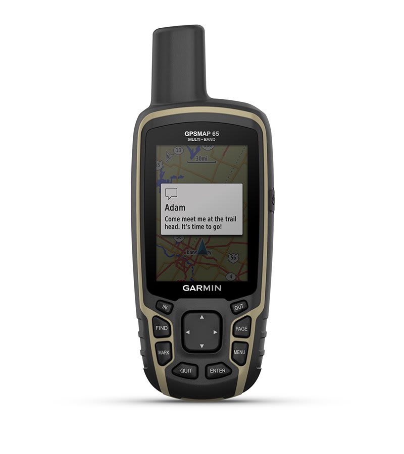
SMART NOTIFICATIONS
Receive emails, texts and alerts right on your handheld when paired with your compatible device.
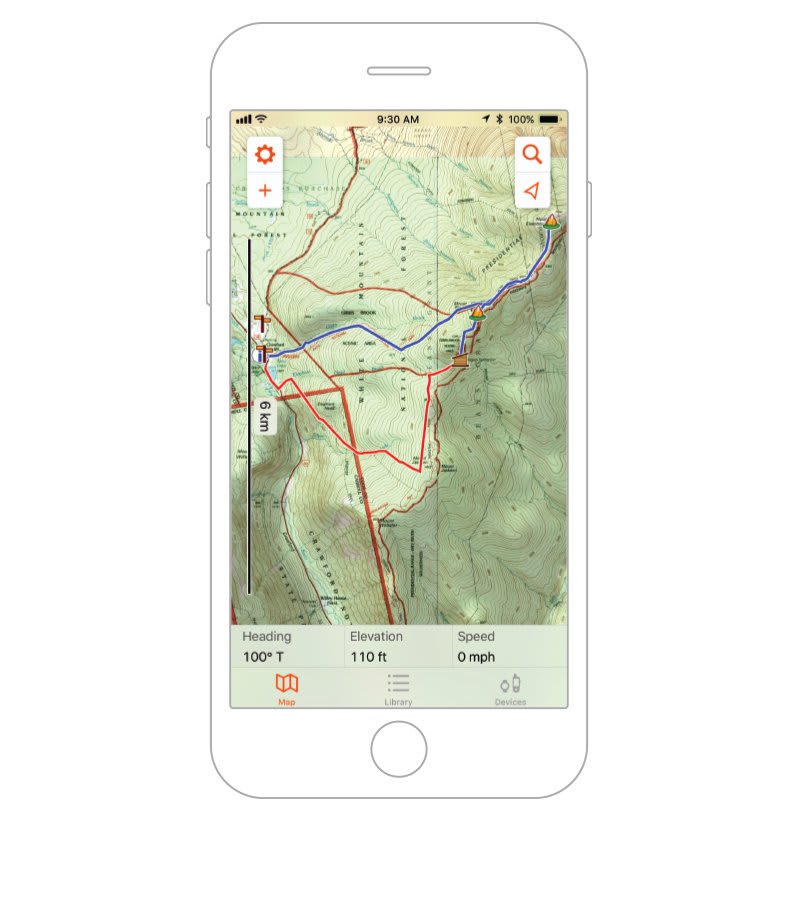
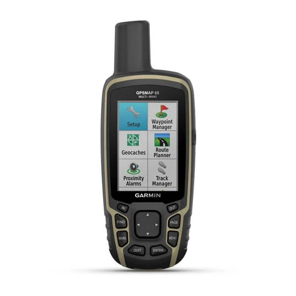
GARMIN EXPLORE APP
Plan, review and sync waypoints, routes and tracks by using the Garmin Explore app1 and website. You can even review completed activities while still in the field.
MICROSD™ SLOT
Using your compatible device and microSD memory card, conveniently download TOPO 24K maps and hit the trail, or access HuntView Plus maps to see public land types and boundaries as well as private landowner names and boundaries.
GEOCACHING
Get paperless geocaches by uploading GPX files straight to your device. View key information such as location, terrain and hints from Geocaching.com.
Physical & Performance
| Display Size | 1.43" x 2.15" (3.6 x 5.5 cm); 2.6" diag (6.6 cm) |
| Battery type | 2 AA batteries (not included); NiMH or Lithium recommended |
| Display resolution | 160 x 240 pixels |
| GPS | Yes |
| Dimension | 2.4" x 6.3" x 1.4" (6.1 x 16.0 x 3.6 cm) |
| Interface | high speed mini USB and NMEA 0183 compatible |
| Waterproof | IPX7 |
| Weight |
7.7 oz (217 g) with batteries |
| Display Type | transflective, 65K color TFT |
| Battery life | 16 hours |
| High-sensitivity receiver | Yes |
Maps & Navigation
| External memory storage | yes (32 GB max microSD™ card) |
| Waypoints/favorites/locations | 5000 |
| Preloaded maps |
yes (TopoActive; routable) |
| Basemap | Yes |
| Navigation Routes | 200, 250 points per route; 50 points auto routing |
| Navigation Track Log | 10000 points, 200 saved tracks |
| Memory/History | 16 GB (user space varies based on included mapping) |
| Ability to add maps | Yes |
Features
| Send route selection to MapShare during trip | No |
| QZSS | Yes |
| BirdsEye | no |
| Send waypoints to MapShare during trip | No |
| Active Weather | No |
| Contacts | No |
| Rinex logging | No |
| inReach remote widget | No |
| Pairs with Garmin Connect™ Mobile | Yes |
| Touchscreen | No |
| LED beacon flashlight | No |
| inReach remote compatible | No |
| Sun and moon information | Yes |
| Virtual keyboard for custom messaging | No |
| MapShare compatible with tracking | No |
| IRNSS | No |
| Geocaching-friendly | Yes (Paperless) |
| Send and receive text messages to other inReach device | No |
| GLONASS | Yes |
| Send and receive text messages to SMS and email | No |
| Frequency band | No |
| Displays national, state and local parks, forests, and wilderness areas | Yes |
| Smart notifications on handheld | Yes |
| Connect IQ™ (downloadable watch faces, data fields, widgets and apps) | No |
| Custom maps compatible | yes (500 custom map tiles) |
| Compatible with Earthmate | No |
| Dog tracking | No |
| Connections Wireless Connectivity |
yes (BLUETOOTH®, ANT+®) |
| LiveTrack | No |
| Exchange locations with other inReach device | No |
| Vibration alert | No |
| Map segments | 3000 |
| Point-to-point navigation | Yes |
| Picture viewer | Yes |
| Barometric altimeter | No |
| Weather | No |
| XERO™ Locations | No |
| Interactive SOS | No |
| VOX (voice activation) | No |
| Automatic routing (turn by turn routing on roads) for outdoor activities | Yes |
| GPS compass (while moving) | Yes |
| Includes detailed hydrographic features (coastlines, lake/river shorelines, wetlands and perennial and seasonal streams) | Yes |
| Multi-band frequency support | Yes |
| Includes searchable points of interests (parks, campgrounds, scenic lookouts and picnic sites) | Yes |
| Hunt/fish calendar | Yes |
| Compass | No |
| Compatible with Garmin Explore™ app | Yes |
| Tracks | 200 |
| Galileo | Yes |
| Garmin Explore website compatible | Yes |
| Area calculation | Yes |
| MIL-STD-810 | No |
| Location reporting (send and receive GPS positions) | No |
| VIRB® Remote | Yes |