


Brunton Map Multi-Tool
Brunton Map Multi-Tool
Regular price
$17.95 USD
Regular price
Sale price
$17.95 USD
Unit price
per
sku: F-MAPTOOL
Shipping calculated at checkout.
Couldn't load pickup availability
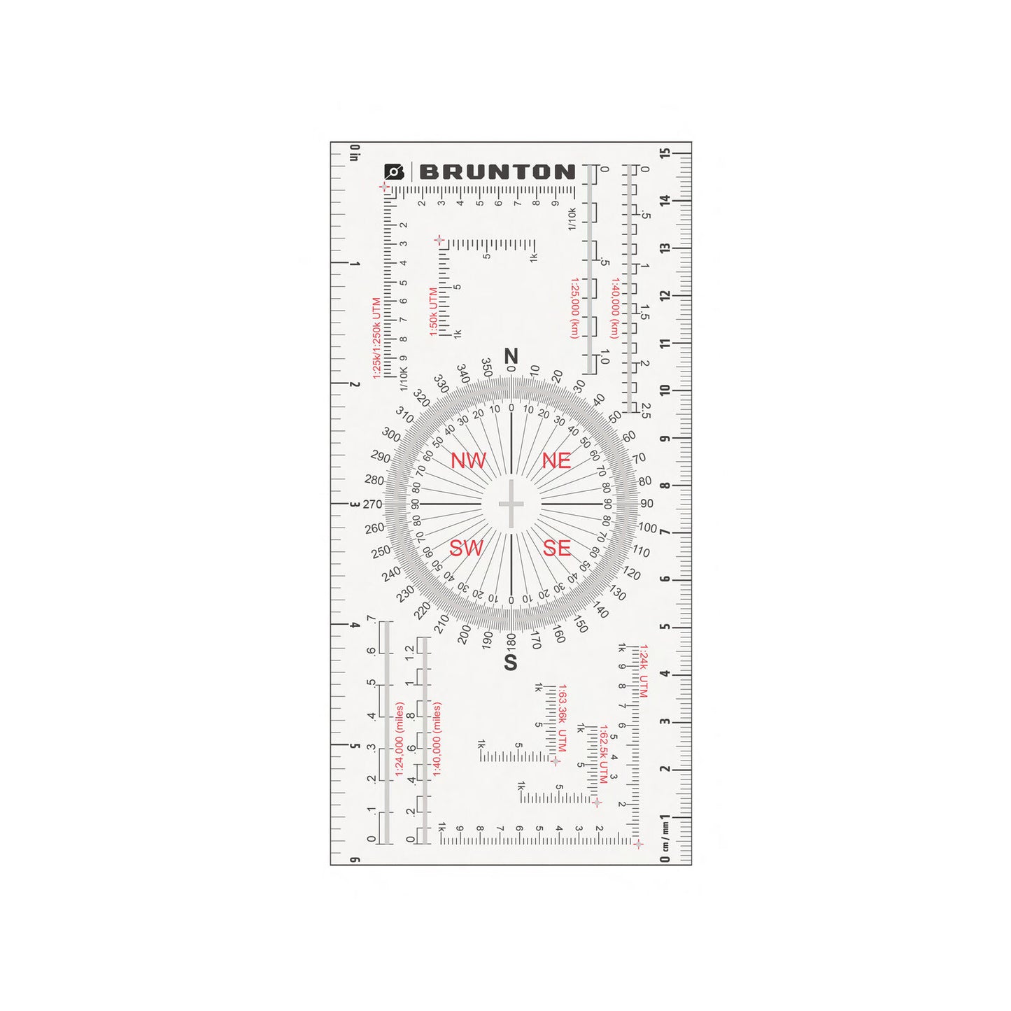
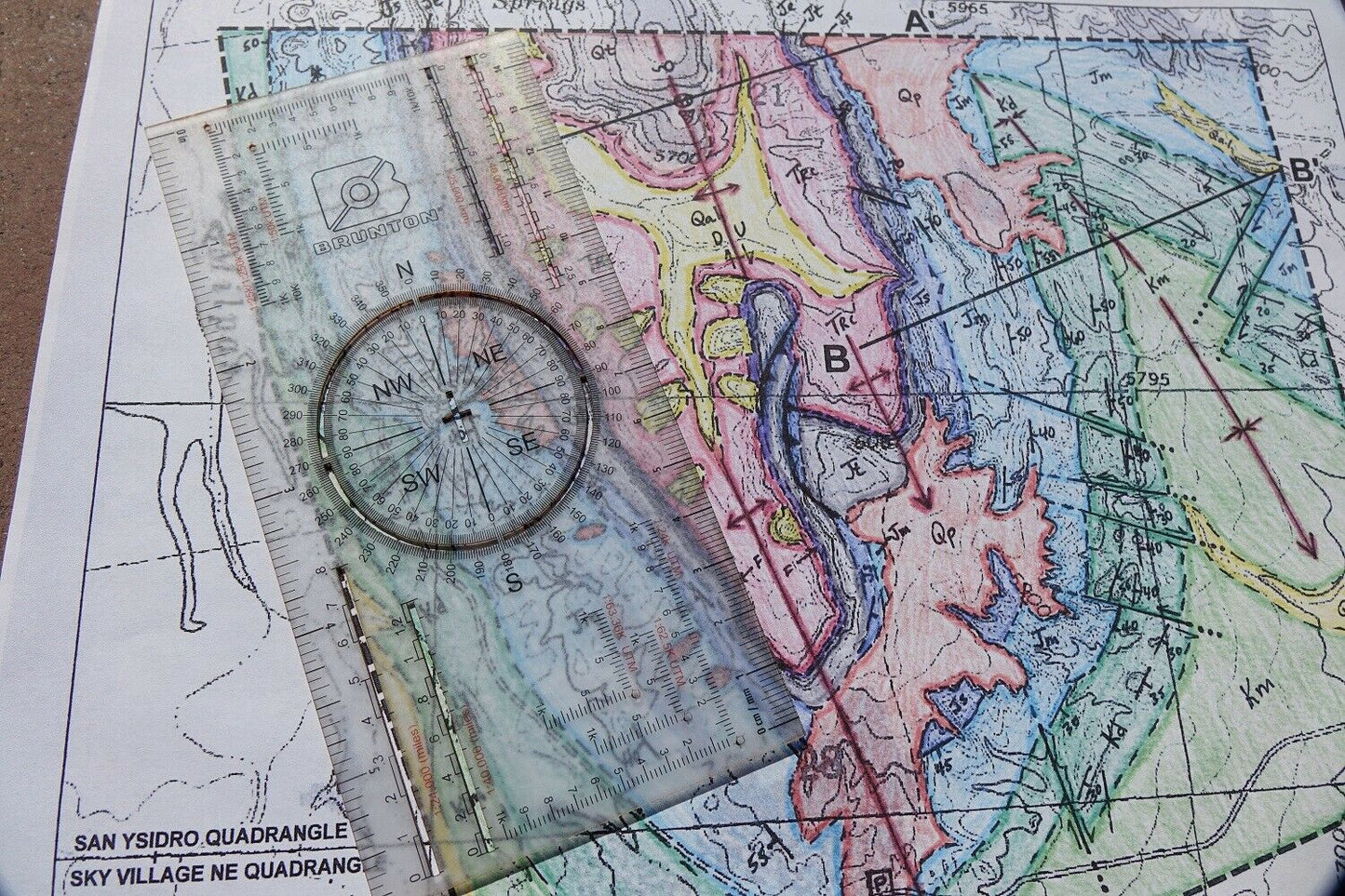
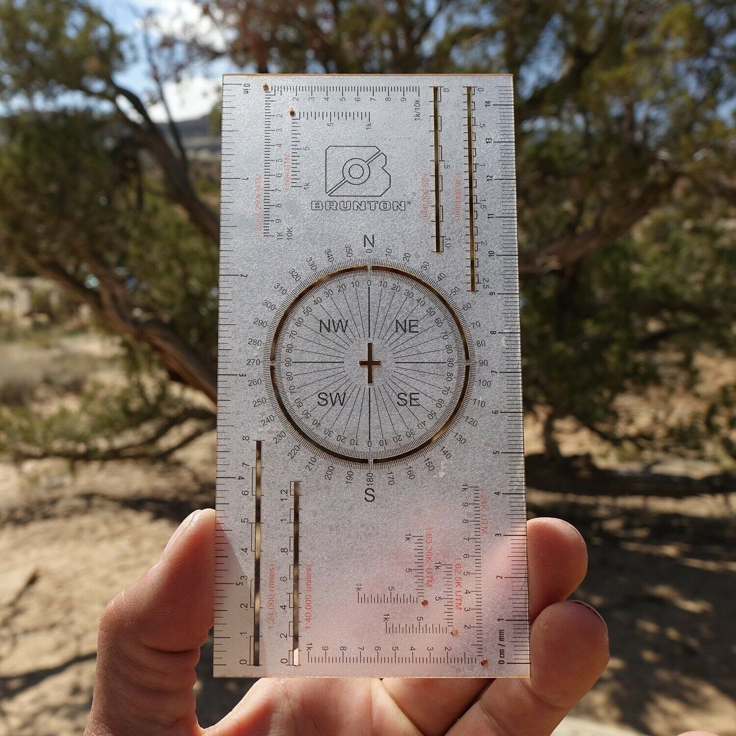
An all-in-one tool that includes standard and metric rulers, Romer grids for common map scales, and a unique protractor for measuring and plotting angles.
SPECS
-
dims: 3” x 6” x 0.03” | 7.6 x 15.2 x 0.7cm
- weight: 0.4oz | 11.3g
FEATURES
- Waterproof, durable, lightweight card can handle exposure to any type of weather
- Card data:
• Inch/10ths and cm/mm rulers.
• Romer Scales for UTM grids at various map scales.
• Map rulers for various map scales.
• 360˚ protractor with unique open circle and strike & dip crosshairs. - Useful for geologists and other field professionals.